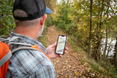
Trail mapping has come a long way since its humble beginnings. What once were hand-drawn sketches and rudimentary charts have evolved into highly accurate, technology-driven tools that enhance our outdoor adventures. Let’s take a journey through the evolution of trail mapping, exploring how it has transformed from simple paper maps to sophisticated digital precision guides.
Early Beginnings: Hand-Drawn Maps
In the early days of exploration, trail maps were often hand-drawn, based on personal experiences and observations. These maps were typically created by explorers, surveyors, or local guides who sketched trails, landmarks, and topographical features as best as they could. While these hand-drawn maps were valuable, their accuracy and detail were limited, often requiring explorers to rely on their intuition and experience.
The Advent of Cartography: Printed Maps
The advent of cartography in the 19th and early 20th centuries brought more standardized and detailed trail maps. With advancements in printing technology, maps became more accessible to the general public. These printed maps featured improved accuracy and clarity, incorporating surveys and measurements to provide a more reliable guide for hikers and adventurers. However, they still had limitations in terms of updating and adapting to changing trail conditions.
The Rise of Topographic Maps
Topographic maps revolutionized trail mapping by introducing contour lines to represent elevation changes. This allowed hikers to better understand the terrain and plan their routes more effectively. Topographic maps provided essential information about the steepness of trails, river crossings, and other critical features. They were a significant step forward in trail mapping, offering more detailed and practical guidance for outdoor enthusiasts.
The Digital Age: GPS and Online Maps
The digital revolution transformed trail mapping once again with the introduction of GPS technology. GPS-enabled devices and online mapping platforms allowed for real-time tracking and navigation, offering a new level of precision and convenience. With the advent of digital maps, hikers could access up-to-date information, including trail conditions, points of interest, and user reviews. Online mapping services also made it easier to create and share custom trails, enhancing the overall hiking experience.
The Era of Interactive Maps: Apps and Real-Time Updates
Today, interactive trail maps and mobile apps have taken trail navigation to the next level. These apps provide real-time updates, including live tracking, weather conditions, and trail closures. Users can access a wealth of information at their fingertips, including detailed route descriptions, elevation profiles, and interactive features that enhance their outdoor experience. Interactive maps have made trail navigation more dynamic and responsive, allowing hikers to adapt their plans based on current conditions.
Precision Mapping: The Future of Trail Navigation
The future of trail mapping is poised for even more innovation. Emerging technologies such as augmented reality (AR) and high-resolution satellite imagery are set to revolutionize how we interact with trail maps. AR could overlay navigational information onto the physical landscape, providing real-time guidance as you explore. Enhanced satellite imagery and mapping techniques will continue to improve the accuracy and detail of trail maps, offering even more precise and reliable navigation tools.
Adventure Maps: Embracing the Evolution
At Adventure Maps, we embrace the evolution of trail mapping by incorporating the latest technologies and techniques to provide the most accurate and user-friendly maps available. Our commitment to precision and innovation ensures that you have the best tools for your outdoor adventures, blending the rich history of trail mapping with cutting-edge advancements.
Exploring the Next Frontier
As trail mapping continues to evolve, adventurers can look forward to even more sophisticated tools that enhance their outdoor experiences. From the early hand-drawn maps to the precision of today’s digital guides, the journey of trail mapping reflects our ever-growing quest for exploration and understanding. With Adventure Maps, you can trust that you’re equipped with the best in trail navigation, ready to tackle your next adventure with confidence and clarity.
Latest Post

Behind the Scenes: How We Create the Most Accurate Trail Maps

How to Choose the Perfect Trail Map for Your Next Adventure


